FIRST WARNS to get you ready for showers, wintry mix, and fog this week.
KANSAS CITY, Mo. (KCTV) -Our pleasant pattern turns quickly tomorrow. Let’s focus on our several FIRST WARNS this week.
1. FIRST WARN tonight through Monday morning’s commute. Fog will be an issue again as it returns this evening and hangs around through tomorrow’s morning commute. This produces dangerously low visibilities. Best to slow down and create extra distance between you and other cars. Keeping your headlights on their normal setting gives you the best view. Brighter high beams reflect off the water droplets and create a greater glare.
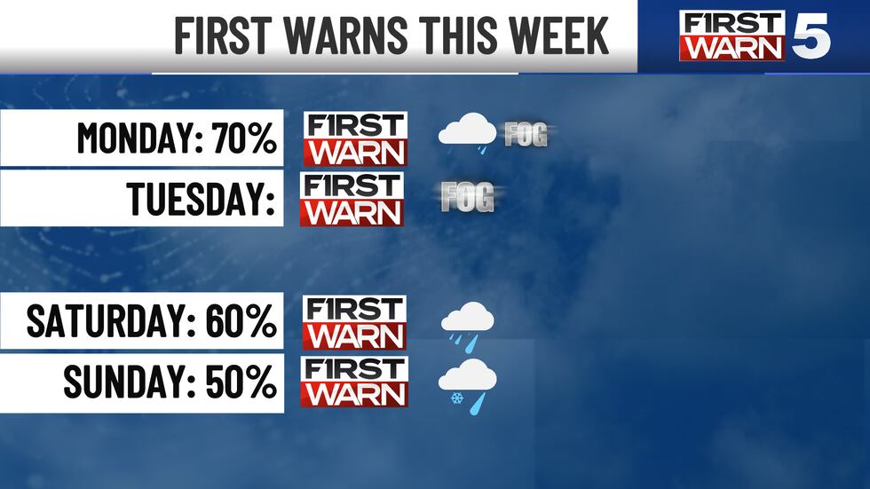
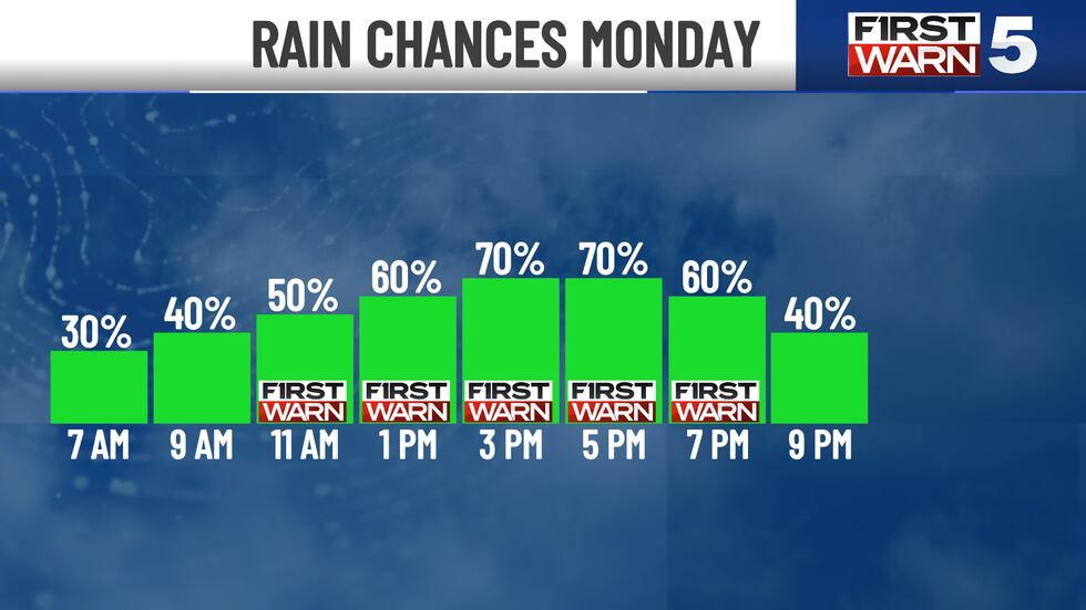
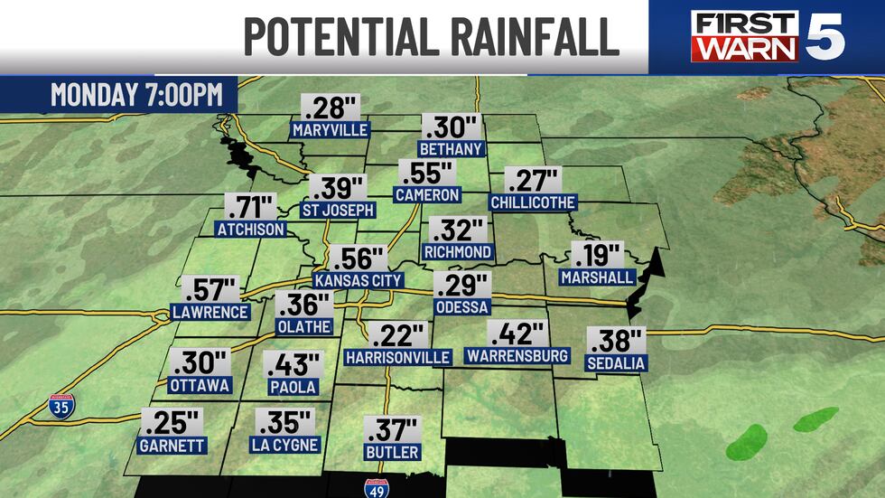
2. FIRST WARN Monday for increasing showers. The most widespread and heaviest showers fall between 11 am and 7 pm. The chance is 50% to 70% during this time. Showers are more scattered during the morning commute, 30% to 40%. Evening showers taper from 40% at 8 pm to 0% by midnight.
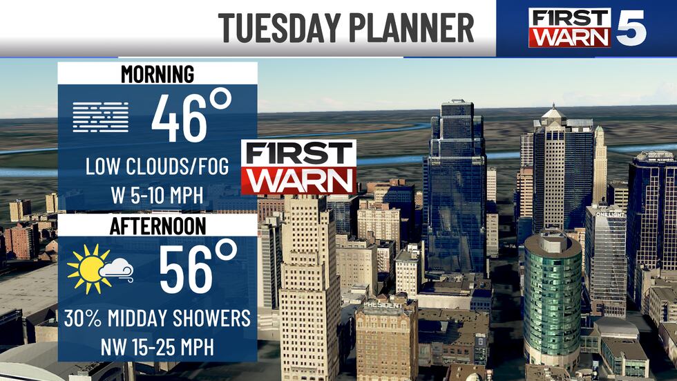
3. FIRST WARN Tuesday for morning fog. Areas of thick fog and dangerously low visibility develop Monday night and last through 10am Tuesday.
4. FIRST WARN Saturday for chilly showers. Signals are getting stronger that most of us will deal with wet weather. Right now, chances sit at 60%. This looks like our most certain storm of the weekend.
If you live in northern Missouri, we see signs that point to snow mixing in with the rain. A bit too much uncertainty to call for any accumulation. Come back for updates. This definitely has our attention.
5. FIRST WARN SUNDAY for a wintry mix. It’s possible another storm, which is even colder, could spread a wintry mix on us Sunday. Only one forecast model currently shows this. The chance sits at 50%. Here’s what it shows. Northeast Kansas and Northwest Missouri would receive accumulating snow. Communities around I-35 have a mixed bag of wintry precipitation. While areas to the south should remain just wet. Another attention-grabbing situation that will become clearer as we get closer.
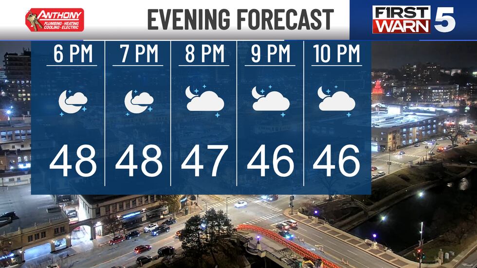
EVENING: Watch out for fog spreading across Missouri, with some areas developing in Kansas. At the same time, high clouds build overhead and hold our temperatures in the mid 40s.
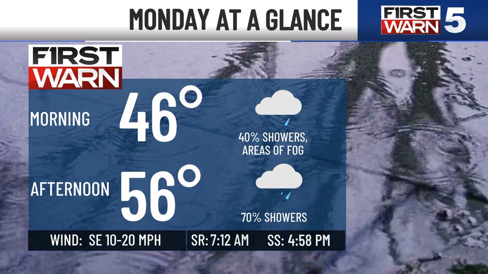
MONDAY: Grab the wet-weather gear. Cloudy all day with a 30%-40% chance for showers and fog as we head back to school and work. Chances ramp up to 50%-70% from mid-morning through the evening commute. Showers move east the rest of the evening, ending by midnight.
Dress for middle 40s to middle 50s.
TUESDAY: Low clouds, along with areas of thick fog, challenge our morning commute. A sharp cold front kicks up a 30% chance for sprinkles to light showers our midday. Once the front passes, gusty northwest winds up to 30mph develop and chase away the clouds. Sunglasses will be needed for the afternoon.
Like Monday, temperatures range from the mid-40s to middle 50s.
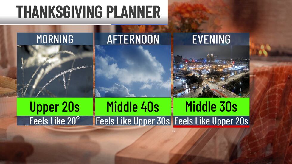
WEDNESDAY and THANKSGIVING DAY: Mainly quiet and cold. Both days feature a mostly sunny sky that struggles to warm us from the mid- to upper 20s to the lower to middle 40s.
FRIDAY: Temperatures mirror the previous two days. The difference is less sunshine with increasing clouds throughout the day.
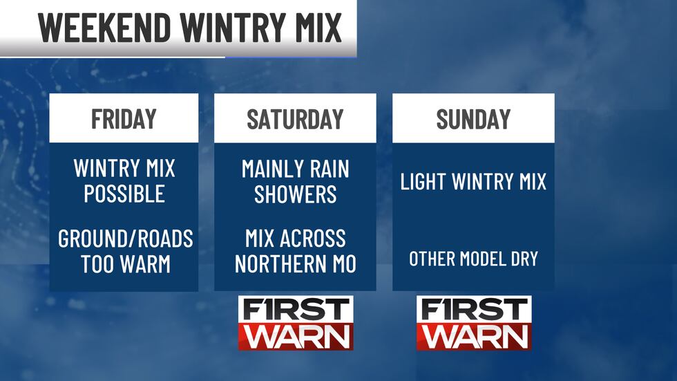
WEEKEND: Looks like a mess. An uncertain mess. We have a 50% to 60% of showers and a wintry mix.
Chilly and likely damp both days with lower 30s to lower 40s.
Copyright 2025 KCTV. All rights reserved.